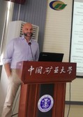
Dr. Simone Lolli 西蒙那·洛力博士

男,意大利国家研究理事会环境分析方法研究所(IMAA-CNR) Senior Research Scientist、意大利佛罗伦萨大学遥感技术工程系教授。2019年11月份受聘环境与测绘学院客座教授,为地理信息科学专业讲授《定量遥感导论》课程。
He is a permanent senior scientist for the Italian National Research Council (CNR) and scientific Co-PI of the NASA MPLNET Lidar Network. He is also graduate program faculty associate member of the University of Maryland Baltimore County(UMBC) and aggregate professor at University of Florence, Engineering Department on Remote Sensing Techniques for Image processing (DINFO). He a Ph.D. degree in Physics from the Ecole Polytechnique, Palaiseau, France and an M.Sc. degree in Physics from the University of Florence, Italy. In the last ten years, Simone developed significant experience in applied atmospheric remote sensing techniques, both from space and from ground, to study aerosol, cloud and precipitation optical, geometrical and microphysical properties, together with their interaction with climate, meteorology, air quality and global earth-atmosphere energy budget. He also participated in several field campaigns in South-East Asia in the frame 7-SEAS NASA mission.
Experience
Consultant, Science Systems and Applications (NASA Contractor) 2019–
Development and implementation of an operational algorithm to detect rain precipitation from NASA MPLNET lidar network measurements
Senior Research Scientist, CNR-IMAAId:17347 (permanent position), Tito Scalo(PZ), Italy 2017–
Research on aerosol and cloud direct radiative effects on the Earth radiation budget and climate by ground-based and satellite remote sensing techniques in the frame of ACTRIS program. Permanent member of the NASAMPLNET Lidar net work Science Team.
Assistant Research Scientist, NASA Goddard Space Flight Center, Greenbelt, MD,USA 2012–2017 Scientific Co-PI of the NASA GSFC MPLNET. The network, since 1999 deployed more than 20 lidar instruments worldwide. Network main objective is to retrieve 24/24 under any meteorological condition the atmospheric profile of the optical and geometrical characteristics of aerosols and clouds to assess their impact on global radiative budget, climate change and air quality.
Projects
GDRI-Sud in South East Asia (SOOT-SEA), PI for black carbon detection and retrieval by lidar measurements in SEA region Eunadics, 2018–
Data Integration and Assimilation for Work Package 4 2017–
7-SEAS, Scientific CO-PI for NASA MPLNET Lidar Network 2012–
NASA MPLNET, Scientific Committee member 2012–
MDE Offshore Wind Energy, CO-Investigator 2012–2013
Publications
50+ publications in peer-reviewed journals and conference proceedings.